Satellite images
Google Earth is a pretty neat program that allows you to view satellite images of just about anywhere on Earth. They have updated their satellite images for a lot of places in China, including Dalian, so I thought I would post some images up here on my blog. I've included reference points to places that I have mentioned in past posts, so you can get an idea of where they are, and if you have Google Earth you can go find them and zoom in, tilt, etc... and get a better view of places in Dalian.
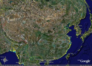
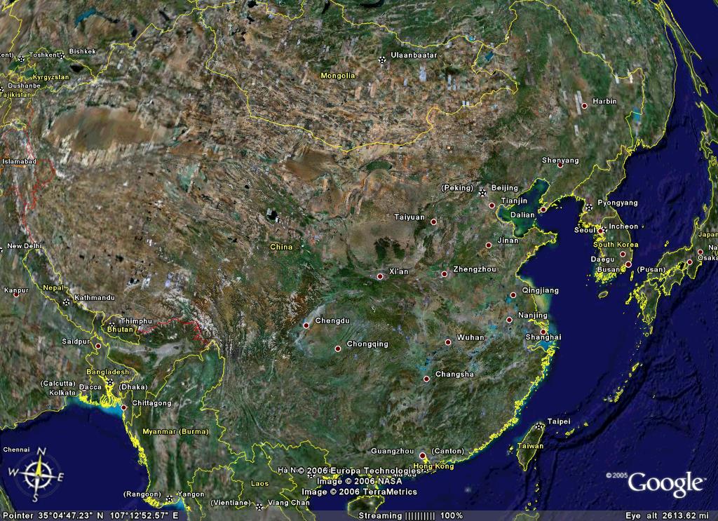
This first image is of all of China. Dalian is located on the east coast between Beijing and Seoul, Korea...
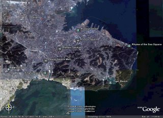
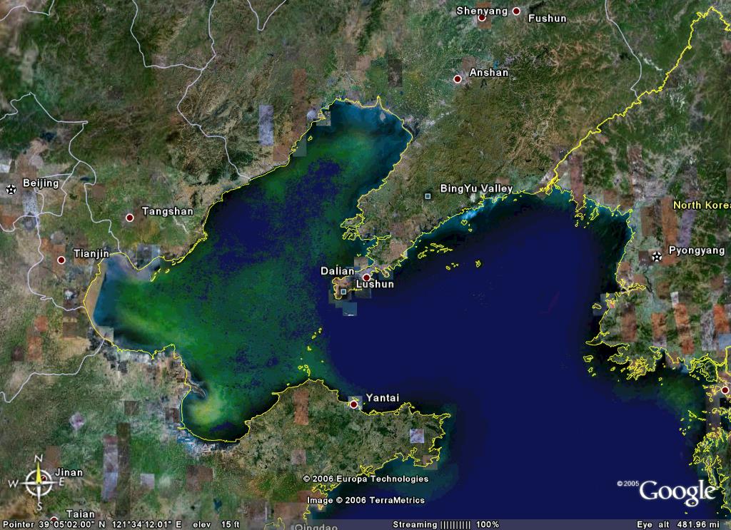
This next view is closer into Dalian. Lushun is to the southwest of Dalian (it may be hard to tell since the program put the names on different sides). I have not figured out where Golden Pebble Beach is yet...

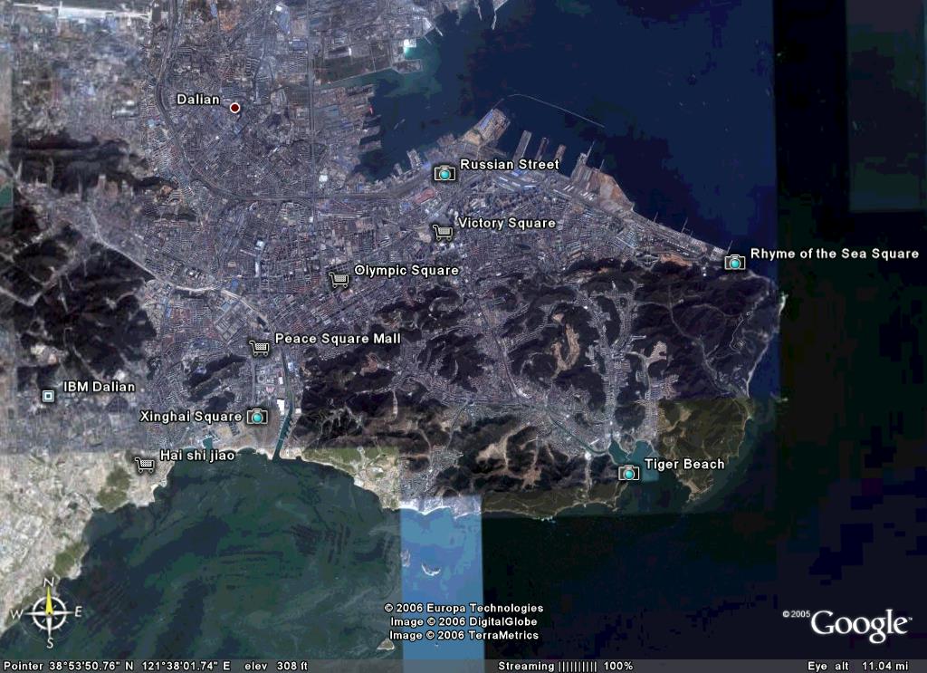
Here is a view of most of the city...
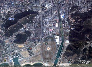
This is a view of where in the city I spend most of my time, either at work or at home...
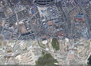
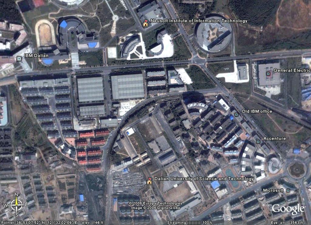
Next is a view of the Dalian Software Park area where my office is...

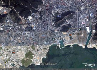
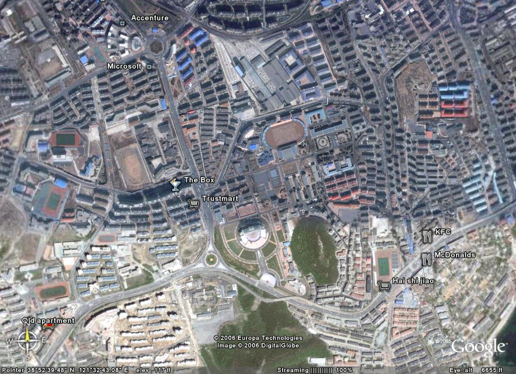
This view is south of the Software Park area which is between where I work and where I currently live, and includes where I use to live...
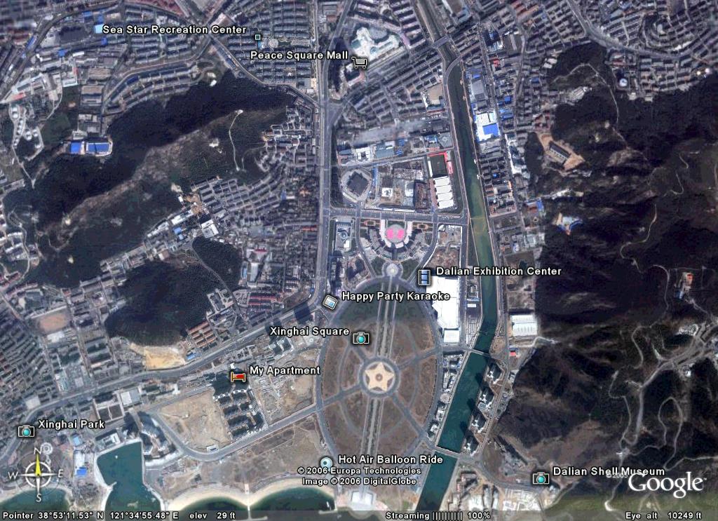
This is a view of the area around where I currently live...
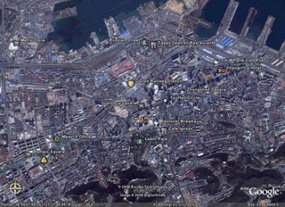
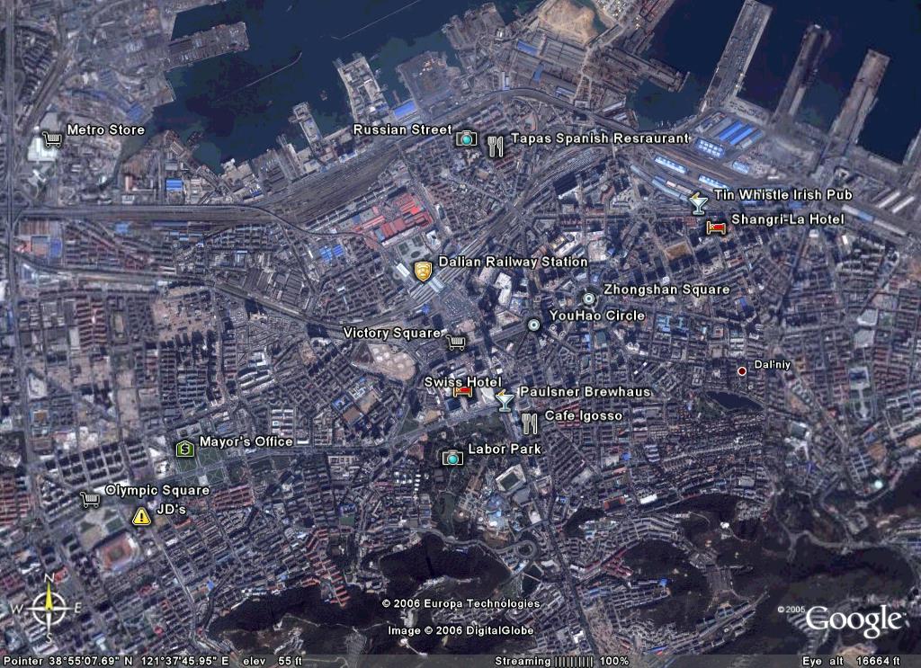
This is an image of the main-downtown area...
If I mention a place in Dalian, and you want the coordinates just leave a comment or send me an email and I'll try to provide them to you.
This first image is of all of China. Dalian is located on the east coast between Beijing and Seoul, Korea...
This next view is closer into Dalian. Lushun is to the southwest of Dalian (it may be hard to tell since the program put the names on different sides). I have not figured out where Golden Pebble Beach is yet...
Here is a view of most of the city...
This is a view of where in the city I spend most of my time, either at work or at home...

Next is a view of the Dalian Software Park area where my office is...
This view is south of the Software Park area which is between where I work and where I currently live, and includes where I use to live...
This is a view of the area around where I currently live...
This is an image of the main-downtown area...
If I mention a place in Dalian, and you want the coordinates just leave a comment or send me an email and I'll try to provide them to you.
posted by Steve Harms at
10:31 AM
![]()


0 Comments:
Post a Comment
<< Home